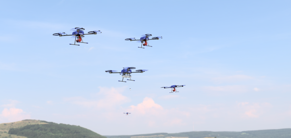
Autonomous Drone Swarms
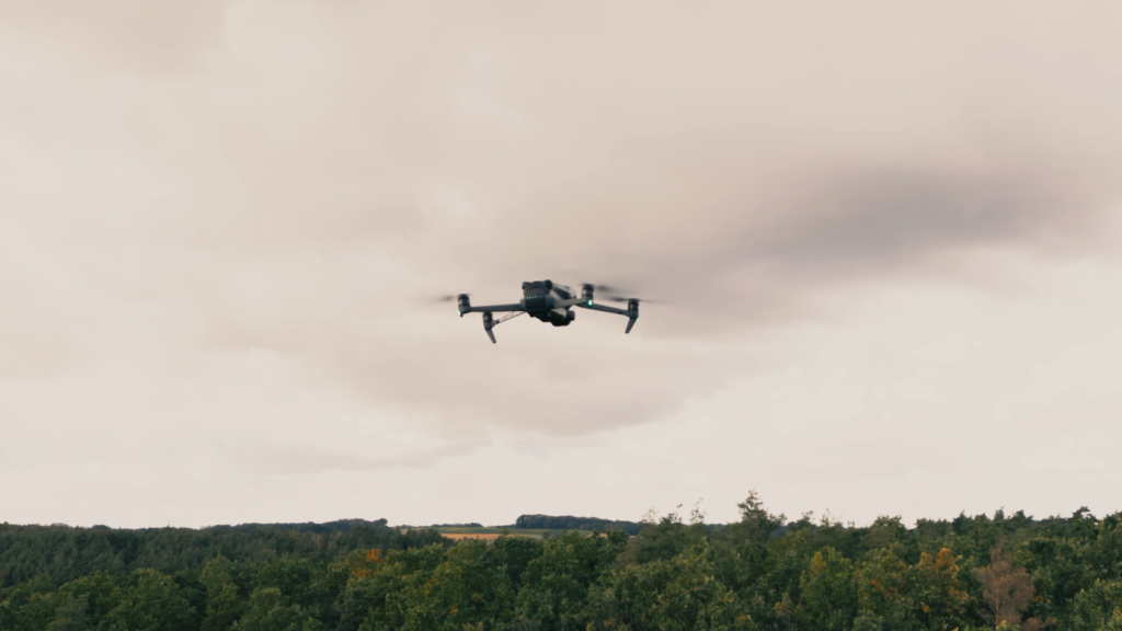
Our software enables drones from the manufacturer DJI to operate as a coordinated swarm. We rely on advanced technologies in route planning that take into account a variety of environmental factors to maximize the efficiency and accuracy of operations. Our solution offers two specialized search modes for firefighting: the fine-grained and the coarse search.
For example, the fine-grained search mode is ideal for detecting embers during the post-fire phase. It allows for a detailed inspection of the affected areas and helps to ensure that even the smallest embers are detected and treated accordingly.
On the other hand, the coarse search mode is designed to provide a comprehensive situational overview in the shortest possible time. It is particularly suitable for the rapid survey of large areas and delivers crucial information required for the effective coordination of firefighting measures.
The swarms are designed to be flexibly exchanged. Drone types and the number of drones can be intuitively and flexibly adapted to the situation, requiring only a simple change in the web app. We take care of the rest.
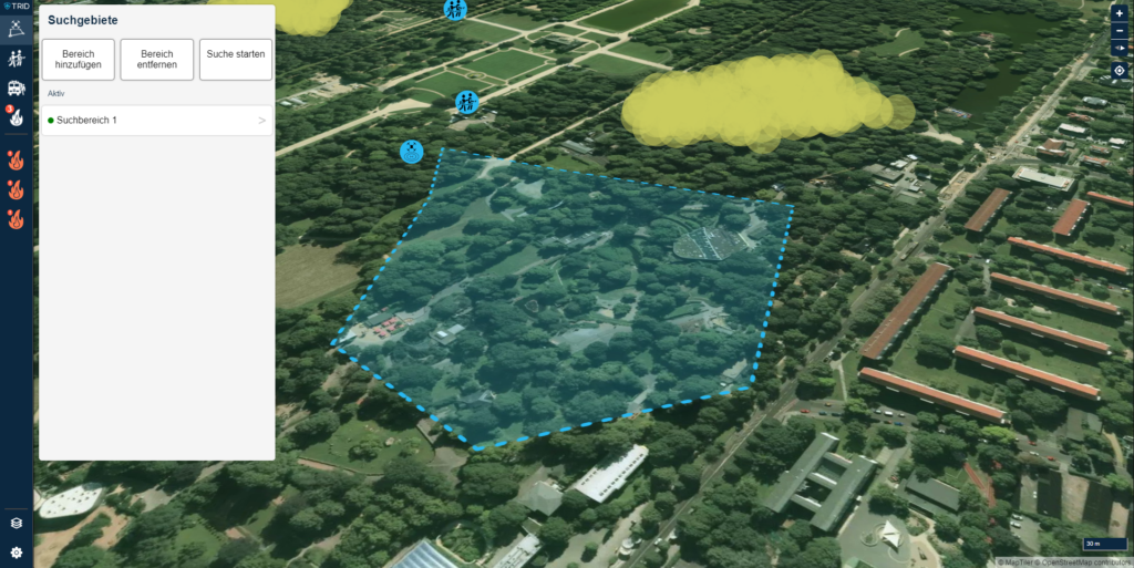
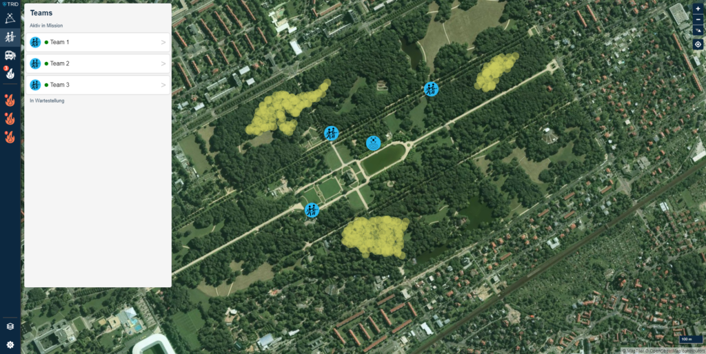
Intuitive WebApp
Our web app revolutionizes the way fire brigade teams fight fires. With an intuitive, user-friendly interface, it’s so easy to use that you can focus on what really matters: quick and efficient firefighting. By simply marking a polygon on the map, you can define a search area in seconds. This information is then immediately transmitted to the DJI drones on site, which take off fully automatically and cover the area. This architecture offers several advantages:
Quick situational assessment: As soon as the drones take off, detected fires and important information are displayed in real time directly in the web app interface. This significantly improves the situational overview and allows for faster response times.
Data efficiency and reliability: Our web app is designed to function reliably even with limited internet access. The data-efficient architecture ensures that you always have control, anywhere and everywhere.
Flexible customization options: Whether it’s drone settings, fire spread models, or team assignments – everything can be configured directly in the web app. This means maximum adaptability to your specific requirements.
Automated Data Processing
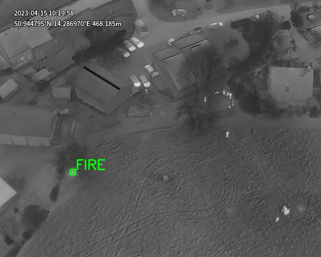
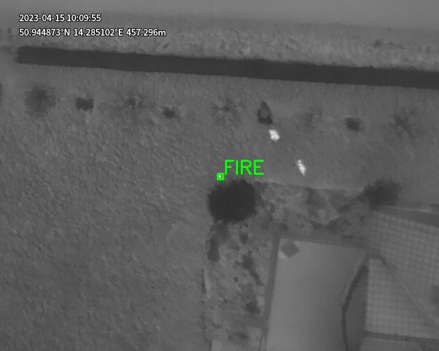
Our software streamlines the flow of information in firefighting operations as smoothly and efficiently as possible. By implementing AI-driven algorithms, we automate the analysis of data collected by drones. This relieves you from the burden of sifting through mountains of information. Instead, you automatically receive only the essential data necessary for assessing and combating the fire situation.
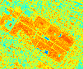
Highest detection precision: Our AI is trained to identify fires in images with impressive precision. In tests, we were even able to reliably detect a small burning candle from a height of 100 meters. This is especially helpful in situations where the finest details matter.
Penetration of vegetation: Another breakthrough of our technology is the ability to detect fires even through the needle layer of trees or layers of leaves. This increases the detection rate in forested or vegetation-covered areas and thus offers a clear advantage in the rapid identification of fire sources.
Fire Propagation Model
Our advanced fire spread model represents another milestone in intelligent firefighting. It combines data collected in real-time by drones with current satellite data to make precise predictions about the future spread of a fire. This integrated analysis allows emergency responders to act proactively rather than reactively by identifying potentially endangered areas in advance and initiating appropriate countermeasures.
Unique data integration: The symbiosis of drone and satellite data provides an unprecedented depth and breadth of information. While the drones ensure a fine-grained capture of the fire source and its immediate surroundings, the satellite data provide an overview of larger, even remote areas. The combination of both data sources enables comprehensive and accurate modeling of fire spread.
Proactive deployment planning: The precise prediction of fire spread allows emergency responders to plan better and allocate resources more targetedly. This not only reduces the risk to life and limb but also helps to minimize property damage.